State Agency:
Ohio Department of Transportation
Office of Geotechnical Engineering
In 2005, in partnership with the Office of Geotechnical Engineering (OGE), tsaADVET implemented Falcon DMS as the document management engine for the ESRI-powered Geotechnical Data Management System (GDMS) at the Ohio Department of Transportation (ODOT). The GDMS, designed to serve as the central repository for geotechnical information for all ODOT projects, was conceived as the ‘one-stop-shop’ for ODOT’s internal and external users (consultants, municipalities, state agencies, and federal agencies – including the Army Corps of Engineers and the Department of Homeland Security). As it matured, the GDMS would provide reliable access to (now) almost a century’s worth of historical project data, active project data, and Geohazards Inventory data critical to public safety. This client profile is a brief history of that effort and tsaADVET’s role in it.
Arguably, the GDMS was impelled in part by an ominous conclusion in a consultant's report:
The Ohio Department of Transportation’s failure to take action to gain control of its historical geotechnical information is potentially a $500,000,000.00 gamble.
This warning of a half-billion-dollar “gamble” was offered in 2004 by an independent GIS/IT consulting firm. The firm, GeoDecisions, was hired in 2003 by the OGE to assess the feasibility of creating a Web-based mechanism to support “fast and accurate storage, retrieval, searching, and viewing of geotechnical-based documents.” Guided by the consultant’s warning, the OGE addressed the threat to its enormously valuable information trove by creating the GDMS, driven by tsaADVET’s Falcon technology. In 2014, the OGE moved its information assets from the GDMS to the Transportation Information Mapping System (TIMS), the Department-wide GIS system now serving all ODOT customers, business partners, and staff. However, the Falcon component of the GDMS remained fully intact. As they did for the GDMS, Falcon Web and the Falcon API continued to serve as the mechanism by which TIMS retrieved and presented the documents and records under Falcon’s control.
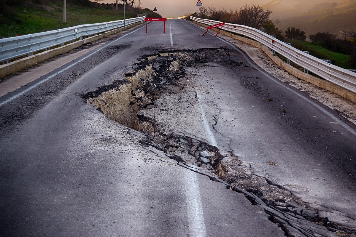
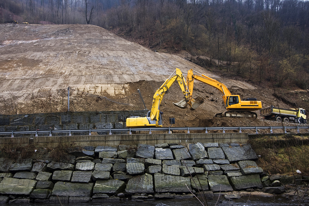
The OGE is responsible for researching and providing design solutions for geotechnical conditions, documenting “geohazardous” situations, and monitoring their remediation (e.g., roads closed by landslides, subsidence, etc.). In support of those efforts, the OGE was maintaining geotechnical project data dating back to the 1920s. In its 2004 report, GeoDecisions established that most of this information was in hardcopy form only. And, there was no backup.
The GeoDecisions report summarized the situation this way: “The current geotechnical archive is a collection of 21,000 hard copy report files representing approximately 75 years of information collection. There a no backup copies of this information; the archive consists of single originals only. This is a very valuable and irreplaceable resource for ODOT. It represents the only store of geotechnical knowledge for ODOT. It is estimated to cost $20,000-25,000 per project if this data is needed to be collected again for future projects. Thus, without the GDMS to provide a digital copy of all of this information (preserving it for future use), ODOT is risking an approximate $500 million loss of essential data. The majority of geotechnical data does not change over time; therefore, it will remain a valuable asset for ODOT.”
Compounding the problem, retrieving information from the archives was neither efficient nor entirely dependable. The process of obtaining information stored at ODOT’s document repository required one to two days and two to three people (add background checks and travel for consultants, and the costs in time and money mounted). Typically, a phone call initiated a document request. After verifying the requestor, staff identified a document’s physical location from a card file system located in a building different from the document repository. Depending on the priority, documents would usually be available to the requestor in a day or two. However, for various reasons, the system was error-prone.
Changes to project referencing that affected document searches were not unusual. For example, projects can “move” from their original location on a road when changes occur to county or route references, so a search for project documents affected by a reference change may not produce all the necessary material. Another weakness in the system was that consultants were sometimes permitted to remove original documents rather than making photocopies. Both examples were cause for concern regarding the utility and security of the original documents.
Boring logs presented a unique problem. Maintained at the District Offices, boring logs were subject to being purged after five to seven years. GeoDecisions identified the boring log as one of the document types containing information that "does not change over time." The District-level purging policy affecting boring logs was one factor causing GeoDecisions to report that the “total amount of geotechnical information being lost is unknown.”
In 2005, with the GeoDecisions report in hand and the OGE committed to proceeding with the GDMS, the Department contracted with tsaADVET to provide Document Management consulting and a Document Assessment Report focusing on the geotechnical documents to be managed by the GDMS.
In the GDSM project’s assessment phase, tsaADVET produced a report of national and international groups’ current document and data standards. Two of the organizations tsaADVET researched were the Association of Geological & Geotechnical Scientists (AGS) and the Consortium of Organizations for Strong Motion Observation Systems (COSMOS).
tsaADVET used the national and international standards report and on-site interviews to design an online survey completed by various ODOT departments and other entities wanting access to OGE’s historical geotechnical information. While the survey’s primary purpose was to identify inconsistencies with or confirm conclusions presented in the GeoDecisions Assessment Report, the survey also guided the implementation in numerous other ways.
Over two weeks in March 2005, tsaADVET collected and compiled input from 40 survey respondents, including personnel from OGE, Structures, Central Office, 11 of ODOT’s 12 District Offices, and numerous ODOT consultants. The information gathered in the survey was also used to:
- Assess user’s needs relating to access to geotechnical documents
- Identify the types of documents appropriate for the GDMS
- Define the scanning and indexing requirements specific to geotechnical data
- Identify the best practices for managing existing electronic archived data
During this period, tsaADVET also studied the OGE’s dead storage vault’s operation and assembled a representative sampling of geotechnical document types maintained within historical project folders.
The first phase ended with the June 2005 release of tsaADVET’s GDMS Document Assessment Report. The report served as a data-capture and document management “cookbook” used to assess the complete historical geotechnical archive and library and covered everything from naming conventions to which information to capture during the massive scanning operation that followed the report’s release.
In August 2005, tsaADVET commenced its second phase. In consultation with tsaADVET, OGE contracted with an Ohio-based imaging firm to scan several million paper documents ranging from 8.5x11 and 11x17 specification documents and 24x26 engineering drawings. As the scanning and indexing operations were to run in parallel, tsaADVET created, on-site, the Falcon database that would ultimately migrate to the ODOT network. Using Falcon’s Document Manager and the Falcon Indexer extension, the imaging staff indexed approximately 50 metadata fields identified for the more than 40 document types and over 100 sub-document types.
When tsaADVET moved the OGE's Falcon installation from the imaging firm to the ODOT network in 2006, the OGE database contained over 1.5 million records. By 2007 an additional 1.2 million specification sheets and approximately 68,000 full-size engineering drawings were scanned and indexed into Falcon; 2014 saw another 1,650,000 specification sheets and over 84,000 engineering draws added.
At this point, Falcon DMS was managing the flow of all data into the GDMS, and Falcon DMS, Falcon Web, and Falcon API were controlling its availability for OGE customers.
In 2010, the GDMS was enhanced further when the OGE contracted with the University of Akron to develop a mechanism by which photographs of geohazardous conditions could be collected and then automatically submitted to Falcon along with the essential metadata for each image.
In 2014, ODOT’s Office of Technical Services implemented the Department’s Transportation Information Mapping System (TIMS). TIMS is a public-facing website whose mission is “to provide ODOT customers, business partners, and staff access to information, facilitating planning and operation needs for ODOT’s transportation network.”
By 2015, TIMS was the single source for information for “over 50 datasets from across six divisions and 16 offices within ODOT, with plans to incorporate an additional 40-50 asset inventories, maintenance work orders, and other datasets as they become available.” When ODOT shuttered the GMDS, the OGE became one of the “16 offices within ODOT” to move its assets and dataset to TIMS. And it’s within TIMS that Falcon continues to function, as essential as ever to the OGE operation.
Though TIMS replaced the GDMS and its searchform-based user interface with interactive maps, Falcon Web remains fundamental to how OGE manages its documents within TIMS.
Rather than using a conventional search form to retrieve documents, the OGE’s customers now interact with geospatial data on the TIMS Map Viewer.
The OGE's maps display precisely located symbols that can represent, for example, a borehole or one of several categories of geohazards (landslide, rockfall, etc.). Clicking a symbol opens a panel showing all the information defined for that point plus several Falcon links. The Falcon links for a borehole includes a 'Project' link, which, when clicked, produces a Falcon search result for all the documents owned by the project to which the current borehole location belongs. Clicking the 'Plan' link produces a more refined Falcon result limited to plan sheets associated with the selected bore location, while the 'Profile' link does the same for profile sheets.
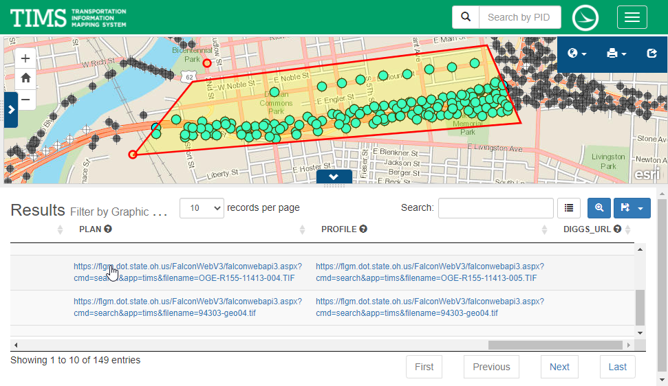
For an 'area' search, the OGE customer draws a polygon containing all the boreholes for which they require documents. TIMS displays a panel listing all the boreholes affected by the polygon and provides the same Falcon links for these multiple boreholes as it did for a single borehole.
Finally, TIMS also provides OGE customers with the same straightforward and reliable access to the vital landslide, rockfall, and subsidence data captured by the University of Akron initiative. Because the Akron geohazard information resides in the Falcon database, there has been no interruption to its development and use.
ODOT and tsaADVET are now partnering on a new scanning and indexing initiative focused on Ohio's roadway network documents. These historical documents go back as far as 1910 and include acquisitions, modifications, and annexations. The project is called the Director's Journal and is currently accessible through Falcon Web. Once fully implemented, the Director's Journal will be available through the TIMS Map Viewer.